
Amellar Statement of Receipts & Expenditures System
A highly advanced system for capturing and reporting receipts and expenditures specially customized for the local government unit treasurers in the country.


Miscellaneous Revenues System
A powerful tool in assessing and collecting miscellaneous revenues that are often neglected such as franchise tax, community tax, professional tax and many others.


Amellar Revenue Collection System
An affordable, highly customized system application specifically designed for local government unit treasurers to help them organize and consolidate all their collection transactions.


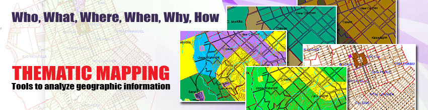
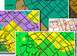
Amellar GIS: Thematic Mapping
A mapping solution that allows users to create different types of maps according to their needs or purposes. It can combine basic information that tells you WHO, WHAT, WHERE, WHEN, WHY and HOW.
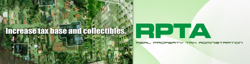
Real Property Tax Administration System
Computerizes and seamlessly intergrates the comprehensive appraisal, assessment, billing, and collection of real property taxes which also covers the RPTA functions and activities of the assessor's and treasurer's offices.


Achievements
Amellar has been in the business of helping LGUs to achieve e-local government since 1994, a total of almost 30 years.
As of 2011, Amellar has 49 LGU Client, consisting of 1 province, 25 cities and 23 municipalities.
Revenue Generation Systems (RGS)
- Real Property Tax Administration (RPTA)
- Has been deployed in 17 cities, 1 province and 24 municipalities.
- Has managed the database construction of nearly 2.0 Million real property records of 42 LGUs.
- Manages more than Php327.7 billion tax bases of LGUs.
- Serve more than 1.2 million accounts.
- Collects more than Php5.5 billion in real property taxes annually.
- Has identified over Php12 billion in tax delinquency.
- Handles more than 3.0 million transactions annually.
- Business Permits Licensing System (BPLS)
- Has been deployed in 11 cities and 21 municipalities.
- Has managed the database construction of more than 213,000 business records of 32 LGUs.
- Manages more than Php824 billion tax bases of LGUs.
- Serve more than 210,000 business accounts.
- Collects more than Php3.0 billion in business taxes, fees, and charges annually.
- Has identified over Php500 million in tax delinquency.
- Handles more than 500,000 transactions annually.
Other RGS applications have been deployed in 8 cities and 6 municipalities.
Geographic Information System (GIS)
GIS applications have been deployed in 13 LGUs, 7 cities and 6 municipalities.
- Basic GIS (abGIS)
- Deployed in 16 LGUs.
- Digitized more than:
- 3,600 Km. of road network.
- 1,500 barangay boundaries.
- 13,000 contour lines with a total length of 52,000 Km.
- Provided technical assistance in parcel mapping and creation of land use and zoning maps, soil maps, etc.
- Trained LGU technical personnel in map production, geo-referencing, database linking, and thematic mapping.
- Expanded GIS
- Digitized more than:
- 539,000+ land parcels covering 110,000+ hectares based on tax maps, cadastral maps, subdivision plans, land titles, etc.
- 310,000+ building footprints and other structures.
- 45,900+ road segments with a total length of 4,200+ Km.
- Matched 70%+ of digitized land parcels with digital records.
- Established the boundaries of barangays and their sections.
- Identified almost 180,000 or 75.2% of digitized building footprints as undeclared or misdeclared.
- Set up the dynamic link up of GIS with RPTA and BPLS databases.
- Trained LGU technical personnel in map production, geo-referencing, database linking, and thematic mapping.
- Digitized more than:
- Internet Mapping
- Antipolo City
- Sharing of geographic data across LGU departments and with the public using the Internet technology.
- Antipolo City
- Crime Mapping
- Muntinlupa City PNP
- GIS-based system to track and analyze crime patterns and trends using the Internet Mapping technology.
- Muntinlupa City PNP